KSB
Честит Великден
С вяра и доброта в сърцата, здрави и силни, да строим за хората! инж. Илиян Терзиев Председател на УС на КСБ

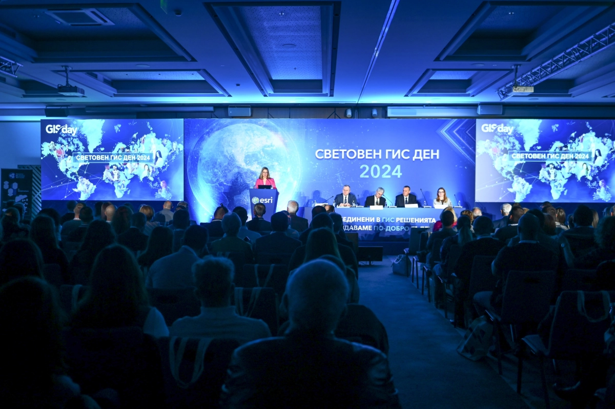
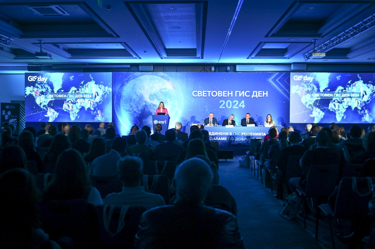
Hundreds of experts from Bulgaria and abroad, representing a wide range of fields, are marking the 25th World Geographical Information Systems Day (GIS) in Bulgaria. The prestigious forum was opened by Valentin Mundrov, acting Minister for e-Government, and Radostin Iliev, acting Deputy Minister of Defence. The 25th…
The prestigious forum was opened by Valentin Mundrov, acting Minister for e-Government, and Radostin Iliev, actingDeputy Minister of Defence
The 25th World GIS Day in Bulgaria is being held under the slogan ‘United in GIS, we create a better future’. The event is organised by Esri Bulgaria and over 50 leading partners. More than 800 GIS experts, leading specialists from various fields of public administration, business and the NGO sector, as well as prominent academics and media representatives, are taking part in this prestigious forum.
The conference began this morning at 9.00 am with an official opening ceremony, attended by Valentin Mundrov, Acting Minister for e-Government, and Radostin Iliev, Acting Deputy Minister of Defence. Both emphasised the increasingly vital role of geotechnologies in their respective fields.
Minister Valentin Mundrov stated: “GIS are becoming indispensable in both the public and private sectors for tackling key challenges – from sustainable development, natural resource management and the electricity distribution network, through to urban planning and Digital Twins, right up to disaster management. The Ministry of e-Government actively supports all state administration bodies seeking to implement and develop GIS, as I recognise their key role in transforming public administration, making it more efficient and transparent.”
During the official opening of World GIS Day, the event’s special guest, Jan Kopel, Business Development Manager at Esri Europe, presented “Sofia Water” AD with the highest international award for Special Achievements in GIS. The utility company’s Geographic Information System was selected from among 100,000 projects from around the world. The award recognises the strategic successes the operator has achieved in applying state-of-the-art GIS technologies. These technologies enable the company to optimise its business processes and improve the quality of the services it provides to its customers. The prestigious award was accepted by Mr Stanislav Stanev, Deputy Executive Director of “Sofia Water” AD.
“90 per cent of all government and military agencies in Europe use Esri ArcGIS as their primary GIS,” Jan Kopel told conference guests, presenting the GIS solutions used by specialists in Ukraine during military operations, for situational awareness and to address the humanitarian crisis in the country. He also explained how GIS technologies were applied in the management of an extremely serious disaster such as the earthquake in Turkey and Syria. Among the other examples presented by Jan Kopel were the applications of GIS in the Natura 2000 network, for ensuring security during the Summer Olympic Games in Paris, for monitoring sea levels, for tackling the crisis of potholes in the UK’s road network, for improving rail transport in Italy, and many others.
Among the special guests at this year’s World GIS Day in Bulgaria was Mihaela Sorostinian, Deputy Director of NATO’s Geospatial Section. She briefed conference participants on the GIS technologies supporting the Alliance’s Situation Centre. Sorostinian spoke about the application of geographic information systems to provide situational awareness to the North Atlantic Council and the Military Committee during times of peace, tension and crisis, as well as during high-level exercises. She also presented the various GIS products and services that NATO’s Geospatial Sector team provides in the land, maritime, air and space domains. This ranges from rapid mapping to the provision of the most up-to-date common operational picture for conflicts and disasters via specialised dashboards and applications.
The conference programme of Bulgaria’s largest GIS event will continue today until 15:30, featuring presentations on the latest technological innovations, global trends in the field of GIS, as well as best practices from Bulgaria and Europe. Some of the most significant and innovative GIS systems and applications implemented in Bulgaria over the past year will be demonstrated live.
Following the conference, the celebrations marking the 25th World GIS Day in Bulgaria will continue with the awards ceremony honouring the winners of the national educational competition ‘Exploring the World with GIS’, under the patronage of the Ministry of Education and Science. We are yet to find out which interactive lessons, innovative teaching resources, digital stories and other GIS projects have been recognised in each of the competition’s four categories: ‘Teachers’, ‘Students’, ‘Pupils’ and ‘School Team’.
World GIS Day is organised by Esri Bulgaria with the support of Geographica, Telelink Business Services, Ciela Norma and Agora 66.
the Bulgarian Academy of Sciences, the Faculty of Geology and Geography at Sofia University “St. Kliment Ohridski”, the Faculty of Economics at Sofia University “St. Kliment Ohridski”, the Faculty of Mathematics and Informatics at Sofia University ‘St Kliment Ohridski’, the University of Architecture, Civil Engineering and Geodesy, ‘Prof. Dr Asen Zlatarov’ University – Burgas, St Ivan Rilski University of Mining and Geology, Chernorizets Hrabar Free University of Varna, Georgi Sava Rakovski Military Academy, University of National and World Economy, New Bulgarian University, St Saints Cyril and Methodius University of Veliko Tarnovo, Higher School of Telecommunications and Post, National University Centre ‘GIT’, Space School Educational Initiative, University of Forestry, Angel Kanchev University of Ruse, UniBIT, Bishop Konstantin of Preslav University of Shumen, Neofit Rilski South-West University, Academy of the Ministry of the Interior, Association of Police Chiefs, Bulgarian Red Cross, Bulgarian Geographical Society, Bulgarian Cartographic Association, Bulgarian Chamber of Mining and Geology, Green Balkans, Society for the Conservation of Nature and Cultural Heritage with GIS – Bulgarian Branch, National Association of Municipalities in the Republic of Bulgaria, Foundation for Local Government Reform, CMDR Centre of Excellence, Chamber of Builders in Bulgaria, Chamber of Architects in Bulgaria, Bulgarian Water Association, Bulgarian Natural Gas Association, Bulgarian Chamber of Commerce and Industry, Union of Urban Planners in Bulgaria, AFCEA Sofia, Institute for Road Safety, Union of Surveyors and Land Planners in Bulgaria, Atlantic Club of Bulgaria, BASCOM, Bulgarian Chamber of Commerce, Union of Architects in Bulgaria, American Chamber of Commerce in Bulgaria, Electronic Communications Association, Technology Industry Alliance, BAGIS, Digital National Coalition and Move.bg.
National Geographic Bulgaria, Dir.bg, Digitalk, bTV Media Group, BNR and Gradat Media Group.
Photographer: Lilia Yotova
С вяра и доброта в сърцата, здрави и силни, да строим за хората! инж. Илиян Терзиев Председател на УС на КСБ

Управляващият орган на Оперативна програма „Иновации и конкурентоспособност“ 2014-2020 (УО на ОПИК) предвижда да обяви процедура за подбор на проекти „Подкрепа на микро- и малки предприятия за преодоляване на икономическите последствия от пандемията COVID-19“ Във връзка с възникнали въпроси от…
Процедура BG16RFOP002-2.073 „Подкрепа на микро и малки предприятия за преодоляване на икономическите последствия от пандемията COVID-19“ ще бъде активирана в ИСУН на 14.05.2020 г. и от 10:00 ч. ще могат да се подават проектни предложения. Крайният срок за подаване на документи е 15.06.2020, 16:30…
От 14.05.2020 г. на уеб сайта на КСБ се предоставя възможност компаниите, вписани в Централния професионален регистър на строителя (ЦПРС), да обменят информация, свързана с участия в проекти по различни оперативни програми; да публикуват обяви относно търсене и предлагане на работна сила…